Shira Plateau: The Complete Kilimanjaro Guide (2026)
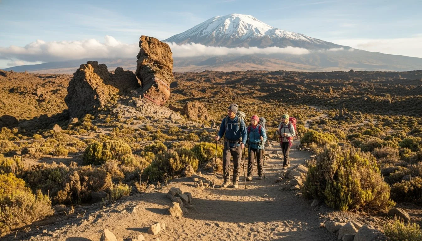
Imagine standing on a vast, windswept plain nearly 4,000 meters above sea level, with the monumental ice fields of Kilimanjaro’s main summit filling the horizon. This isn’t a dream; it’s the reality of trekking across the Shira Plateau, one of the most stunning and geologically fascinating areas on the world’s tallest freestanding mountain.
The Shira Plateau is more than just a landscape; it’s the ancient, collapsed heart of one of Kilimanjaro’s original volcanoes. Let’s explore this incredible high-altitude desert, from its volcanic origins to the Lemosho and Shira trekking routes that cross its otherworldly terrain.
Shira Plateau: Quick Trekking Facts
|
Feature |
Detail |
|
Average Elevation |
3,800 meters (12,467 feet) |
|
Best Route to Access |
Lemosho Route (8-Day recommended) |
|
Geological Status |
Extinct volcanic caldera (Oldest on Kilimanjaro) |
|
Highlight Landmark |
Shira Cathedral (3,895m) |
|
Difficulty |
Moderate (Plateau is flat, but altitude is high) |
What and Where is the Shira Plateau?
The Shira Plateau is a massive high-altitude tableland located on the western side of Mount Kilimanjaro in Tanzania. It sits at an elevation between 3,500 and 3,800 meters (11,500 to 12,500 feet) and serves as the collapsed caldera of the extinct Shira volcano.
Located within Kilimanjaro National Park, a UNESCO World Heritage Site, the plateau stretches for about 13 kilometers west of Kibo. When you walk across its expanse, you are literally trekking inside the remains of one of Kilimanjaro’s three volcanic cones.
The Landscape and Weather: A High-Altitude Savannah
Stepping onto the Shira Plateau feels like entering another world. It’s a wide-open expanse of Afro-alpine heath and moorland, a stark contrast to the lush rainforest on the mountain’s lower slopes.
-
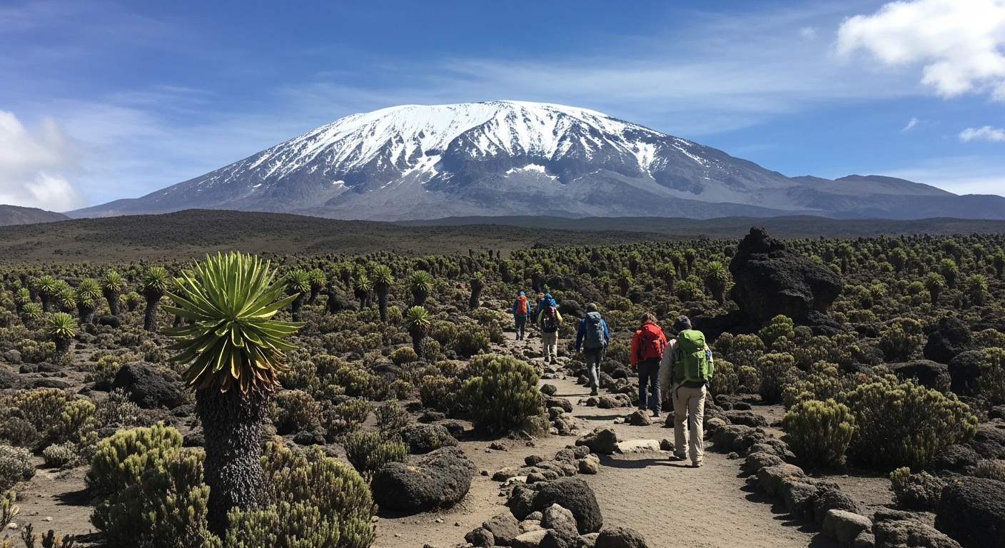
Flora & Fauna: You’ll encounter Giant Groundsels (Senecios) and Lobelias, prehistoric-looking plants specially adapted to extreme UV rays and nightly frosts.
-
Geology: The ground is composed of ancient volcanic rock, solidified lava flows, and ash from eruptions 500,000 years ago.
-
Visibility: On clear days, you get an unobstructed panorama of Kibo’s glaciated peak and the distant silhouette of Mount Meru.
Climate of Extremes: Packing for the Plateau
The weather on the Shira Plateau changes in a heartbeat. Because of the exposed terrain, wind chill is a significant factor.
|
Condition |
Typical Experience |
Essential Gear |
|
Daytime |
Mild and sunny ($15^\circ\text{C}$ to $20^\circ\text{C}$) |
UV Protection, Polarized Sunglasses |
|
Nighttime |
Drops below freezing ($-5^\circ\text{C}$ to $-10^\circ\text{C}$) |
4-Season Sleeping Bag, Thermal Base Layers |
|
Unexpected |
Sudden fog, hailstorms, or high winds |
Gore-Tex Shell, Waterproof Rain Gear |
The Landscape and Weather of the Shira Plateau
Stepping onto the Shira Plateau feels like entering another world. It’s a wide open, windswept expanse of Afro alpine heath and moorland, a stark contrast to the lush rainforest on the mountain’s lower slopes.
A High Altitude Savannah
The landscape is mostly flat or gently rolling, covered in tough tussock grasses and unique plants built for survival. You’ll see giant groundsels (senecios) and lobelias dotting the terrain, flora specially adapted to the extreme conditions. The ground beneath your feet is ancient volcanic rock, the solidified lava flows and ash from eruptions hundreds of thousands of years ago. This gives the entire area a beautiful, barren, and almost surreal feeling.
When the skies are clear, the views are simply unparalleled. You get an unobstructed panorama of Kibo’s glaciated peak to the east, and on a good day, you can even spot Mount Meru on the horizon.
A Climate of Extremes
The weather on the Shira Plateau can change in a heartbeat. Because of its high altitude, you can expect dramatic daily temperature swings.
-
Daytime: Can be surprisingly mild and sunny.
-
Nighttime: Temperatures regularly drop well below freezing.
It’s not unusual to experience warm sun, a sudden chilly fog, and even a brief hailstorm all in one afternoon. Wind is also a major factor on this exposed plateau, making it feel much colder. Trekkers often wake up to frost on their tents. Packing in layers, including a warm hat, rain gear, and a windbreaker, is absolutely essential.
Key Facts About the Shira Plateau
-
Geological Origin: The Shira Plateau is the remnant of Shira, the oldest of Kilimanjaro’s three volcanic cones (the other two being Mawenzi and Kibo).
-
Size and Altitude: The plateau covers a massive area of approximately 6,200 hectares and sits at an average elevation of 3,800 meters.
-
Highest Point: The highest remaining point of the old crater rim is Johnsell Point, which reaches 3,962 meters.
-
Wildlife Sightings: While rare, large animals like elephants, buffalo, and eland occasionally wander up from the plains of Kenya’s Amboseli National Park.
-
UNESCO Status: The entire Kilimanjaro National Park, including the Shira Plateau, was declared a UNESCO World Heritage Site in 1987.
The Ancient Volcanoes and Peaks of Shira
The Shira Plateau isn’t just a flat plain, it’s a landscape defined by the remnants of its violent volcanic past. The features you see today tell the story of a mountain that once stood as tall as Kibo.
Shira Volcano
Shira was once a mighty volcano in its own right. After its eruptive period, it collapsed inward, creating the huge caldera we now call the Shira Plateau. Over millennia, subsequent eruptions from Kibo filled the caldera with lava and ash, smoothing it into the vast plain trekkers cross today. The legacy of the Shira volcano is this incredible, walkable high altitude plain that provides a gateway to Kilimanjaro’s summit from the west.
Shira Ridge
The Shira Ridge is what’s left of the original volcano’s crater wall. This eroded, horseshoe shaped rampart of rock defines the western and southern edges of the plateau. The highest points on this ridge, like Johnsell Point (3,962 m) and Klute Peak, are technically the summits of the Shira volcano. Standing on the Shira Ridge gives you a profound sense of Kilimanjaro’s scale and multi volcano composition.
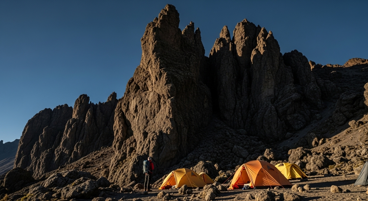
Shira Cathedral
One of the most iconic landmarks is the Shira Cathedral (3,895 m). This is a dramatic, pyramid shaped spire of rock rising from the southern rim of the plateau. It’s called the “Cathedral” because its jagged form resembles the architecture of a great stone church. It’s a popular and highly rewarding side hike for climbers looking to acclimatize, offering breathtaking 360 degree views of the plateau, Kibo’s summit, and the valleys below.
Other Summits and Hills
The area is dotted with other notable features, all remnants of the ancient volcano.
-
The Shira Needle: A sharp, freestanding pinnacle of rock sculpted by erosion.
-
The Cone: A smaller feature that was likely a minor vent of the Shira volcano.
-
East Shira Hill: A rise on the eastern side of the plateau, offering great views back across the plain.
Exploring these minor peaks is a fantastic way for trekkers to aid their acclimatization while taking in the stunning scenery of the Shira Plateau.
Kilimanjaro Trekking Routes: Shira vs. Lemosho
Most trekkers reach the plateau via the Western Approach. However, choosing the right route is the difference between a successful summit and a premature descent.
Choosing Your Path: Lemosho vs. Shira Route
While both routes traverse the plateau, the starting point dictates your safety and success rate.
|
Metric |
Lemosho Route (Recommended) |
Shira Route |
|
Day 1 Start Alt |
2,100m (Rainforest) |
3,400m (Morum Barrier) |
|
Acclimatization |
Excellent: Gradual ascent. |
Poor: High risk of altitude sickness. |
|
Success Rate |
95%+ with Duma Explorer |
Lower due to rapid ascent |
|
Scenery |
Full variety (Rainforest to Arctic) |
Skips the Rainforest zone |
|
Crowds |
Low/Moderate |
Low |
Why Duma Explorer Recommends Lemosho: As a KPAP-partner and ethical operator, we prioritize safety. The Lemosho route allows for a much gentler transition to high altitude, resulting in a summit success rate of over 95% for our clients.
Trekking Across the Shira Plateau
The Shira Plateau is a highlight of all the western approach routes on Kilimanjaro. Its relatively gentle terrain allows trekkers to catch their breath and soak in some of the best views on the entire mountain.
The Shira Plateau Route
The Shira Plateau Route is one of Kilimanjaro’s official climbing routes, though it’s less common today. It was the original western approach, known for its very high starting point. Trekkers are driven up to the Morum Barrier at around 3,400 meters to begin their hike.
While this gets you to the amazing views quickly, starting at such a high elevation can make acclimatization difficult. The risk of altitude sickness is higher on day one, which is why most operators now favor a more gradual approach.
Lemosho Route vs. Shira Route: What’s the Difference?
This is a common point of confusion for climbers. Both routes approach from the west and cross the Shira Plateau, but they have one crucial difference at the start.
-
The Shira Route starts high, driving you up to the plateau and skipping the forest zone entirely. It’s shorter but poses a greater acclimatization challenge.
-
The Lemosho Route starts much lower, at the Londorossi Gate. The first day is spent hiking through beautiful, pristine rainforest, allowing for a much gentler and safer acclimatization profile. Trekkers on the Lemosho route reach the Shira Plateau on their second day.
Which is better? The overwhelming consensus among expert guides is that the Lemosho Route is the superior choice. It has a much higher success rate because the gradual ascent gives your body more time to adapt to the altitude. You also get to experience the incredible biodiversity of Kilimanjaro’s rainforest, an experience missed on the Shira Route. For this reason, experienced operators like Duma Explorer strongly recommend the Lemosho route to maximize safety and your chances of reaching the summit.
“Which Route Am I On?” A Simple Check
Because some companies use the names interchangeably, here’s how to know for sure. If your first night on the mountain is spent at Mti Mkubwa (Big Tree Camp) in the forest, you are on the Lemosho Route. If you are driven up to a high plain and camp your first night at Shira Camp 1 or Simba Camp, you are on the Shira Route.
A Typical Shira Plateau Route Itinerary
For those who do take the Shira Route, a typical 7 day itinerary looks something like this.
Day 1: Drive to Morum Barrier, Hike to Simba Camp
The journey begins with a long 4x4 drive to the Morum Barrier (3,405 m) on the Shira Ridge. From here, the trek starts with a short and gentle walk of 2 to 3 hours across the plateau to Simba Camp (around 3,600 m), your home for the first night.
Day 2: Across the Shira Plateau to Shira Camp 2
This is a beautiful day of trekking across the heart of the plateau. You’ll pass giant senecios and enjoy constant views of Kibo’s summit. The day ends at Shira Camp 2 (Shira Huts) at around 3,810 meters. Here, the Shira and Lemosho routes merge.
Day 3: To Lava Tower and Barranco Camp
A classic acclimatization day. You’ll “climb high, sleep low” by trekking up to the impressive Lava Tower at 4,530 meters before descending into the stunning Barranco Valley to camp at 3,950 meters.
Days 4 to 7: The Summit Push and Descent
From Barranco, the route continues up the famous Barranco Wall, on to Karanga Camp, and then to Barafu High Camp (4,673 m). The summit attempt begins around midnight, aiming to reach Uhuru Peak (5,895 m) at sunrise. The descent follows, typically down the Mweka Route.
Can't-Miss Landmarks on the Shira Plateau
-
Shira Cathedral: A jagged rock buttress on the western spire. A 1-hour detour here is the best way to "climb high, sleep low."
-
Lava Tower: While technically on the edge of the plateau, this 90m volcanic plug is a landmark you'll see as you transition toward the Barranco Valley.
-
The Morum Barrier: The highest drivable point on the mountain and the gateway for those doing Shira Plateau day trips.
How to Reach the Shira Plateau
There are two main ways to experience the Shira Plateau.
-
Trekking on a Kilimanjaro Climb: The best way to fully experience the plateau is by climbing Kilimanjaro via the Lemosho, Shira, or Northern Circuit routes. These routes spend one to two days traversing its magnificent landscape.
-
By 4x4 Vehicle for a Day Trip: It is possible to drive to the edge of the Shira Plateau. This makes for an incredible day trip for visitors who aren’t climbing the full mountain but want to experience its high altitude environment. A guided tour can take you up for a day of hiking and a picnic with some of the best views in Africa.
Driving access is via a rugged 4x4 track from Londorossi Gate to the Morum Barrier. This is not a self drive route, it must be arranged with a licensed tour operator who can secure park permits and provide a guide. If a day trip to this unique part of Kilimanjaro sounds amazing, you can contact us about creating a custom itinerary that includes this adventure.
Ethical Trekking and Conservation
When you visit the Shira Plateau with Duma Explorer, you aren't just a tourist; you are a partner in Ethical Tourism.
-
Fair Wages: We are a founding partner of the Kilimanjaro Porters Assistance Project (KPAP), ensuring our mountain crew receives fair compensation and proper gear.
-
Environmental Stewardship: We are one of only six Travelife Certified companies in Tanzania. We practice "Leave No Trace" principles to protect the delicate Afro-alpine ecosystem.
-
Safety First: Every trek is led by Wilderness First Responder (WFR) certified guides, equipped with emergency oxygen and pulse oximeters.
Shira Plateau FAQ
Can you see wildlife on the Shira Plateau?
It’s possible but very rare. The environment is harsh, but elephants and buffalo have been spotted here. You are far more likely to see their tracks than the animals themselves. For guaranteed wildlife viewing, a traditional safari is your best bet.
Is the Shira Route good for beginners?
Generally, no. Because of the high starting altitude and poor acclimatization profile, the Shira Route is not recommended for most first time climbers. The Lemosho route offers the same spectacular scenery with a much safer and more successful ascent profile.
Can I do a day hike on the Shira Plateau?
Absolutely! A guided day trip by 4x4 is a fantastic way to experience a piece of Kilimanjaro without committing to a full summit climb. You can hike to landmarks like the Shira Cathedral and be back at your camp or lodge by evening.
What should I pack for a hike on the Shira Plateau?
Layers are key. You will need warm layers, a waterproof and windproof outer jacket, sunscreen, sunglasses, a warm hat, and gloves. Even on a day trip, the weather can turn cold and windy very quickly.
Whether you cross it on your way to the Roof of Africa or visit for a single, breathtaking day, the Shira Plateau is an unforgettable part of the Kilimanjaro experience. Its vast, ancient landscape offers a sense of peace, power, and perspective that stays with you long after you’ve descended.
Ready to plan your own adventure? The expert team at Duma Explorer has over 15 years of experience leading safe and successful climbs on Kilimanjaro and can help you choose the perfect route for your journey.
How cold does it get on the Shira Plateau?
During the day, it stays around 15°C (59°F), but once the sun sets, temperatures plummet. Expect -5°C to -10°C (23°F to 14°F) and frequent morning frost on your tent.
Is the Shira Plateau flat?
Relatively, yes. Compared to the steep "Wall" sections of Kilimanjaro, the plateau is a high-altitude moorland with gentle undulations, making it the most relaxing walking terrain of the trek.
Can I see Mount Meru from the Shira Plateau?
Yes! On clear mornings, looking west across the clouds, you can see the distinct silhouette of Mount Meru, Africa’s fifth-highest peak.
What is the best month to visit?
The dry seasons—January to March and June to October—offer the clearest views of Kibo from the plateau.