Rongai Route Kilimanjaro Guide 2026: 7-Day Itinerary
Thinking about climbing Mount Kilimanjaro? The Rongai Route is the only trekking path that starts from the mountain’s northern side, close to the Kenyan border. If you’re looking for a trail with fewer crowds, incredible wilderness, and a high chance of success, this unique route might be your perfect match for experiencing the Roof of Africa.
Rongai Route at a Glance
-
Total Distance: 73 km (45 miles)
-
Duration: 6 or 7 days (7 days highly recommended)
-
Difficulty: Medium (No technical scrambling)
-
Success Rate: ~85% (7-day itinerary)
-
Key Feature: Only route approaching from the North; driest path on the mountain.
-
Best Season: Year-round, but superior during the rainy seasons (April-May & Nov).
What is the Northern Approach?
The Rongai Route is famous for being the only trekking path that starts from Mount Kilimanjaro’s northern side, close to the border between Kenya and Tanzania. All other popular trails, like the Machame Route and Lemosho, begin on the southern or western flanks. This northern starting point means a more remote and unspoiled journey. Trekkers often walk for days in peaceful solitude, seeing very few other groups until the trail merges with the Marangu Route for the final summit push. If you’re still comparing options, see our overview of Kilimanjaro climbing routes.
A major advantage of this northern approach is the weather. This side of the mountain sits in a rain shadow, meaning it gets significantly less rain than the southern face. This results in drier, clearer conditions, making the Rongai Route an excellent choice, especially if you plan to climb during Kilimanjaro’s wetter seasons.
|
Feature |
Rongai Route |
Machame/Lemosho |
Marangu (Coke) |
|
Crowd Level |
Low (Very Quiet) |
High |
High |
|
Scenery |
Wilderness & Mawenzi Peak |
Lush Rainforest & Barranco |
Constant views, same path up/down |
|
Difficulty |
Moderate (Gradual) |
High (Steep/Scrambling) |
Moderate |
|
Accommodation |
Camping |
Camping |
Huts |
|
Success Rate |
High |
High |
Medium |
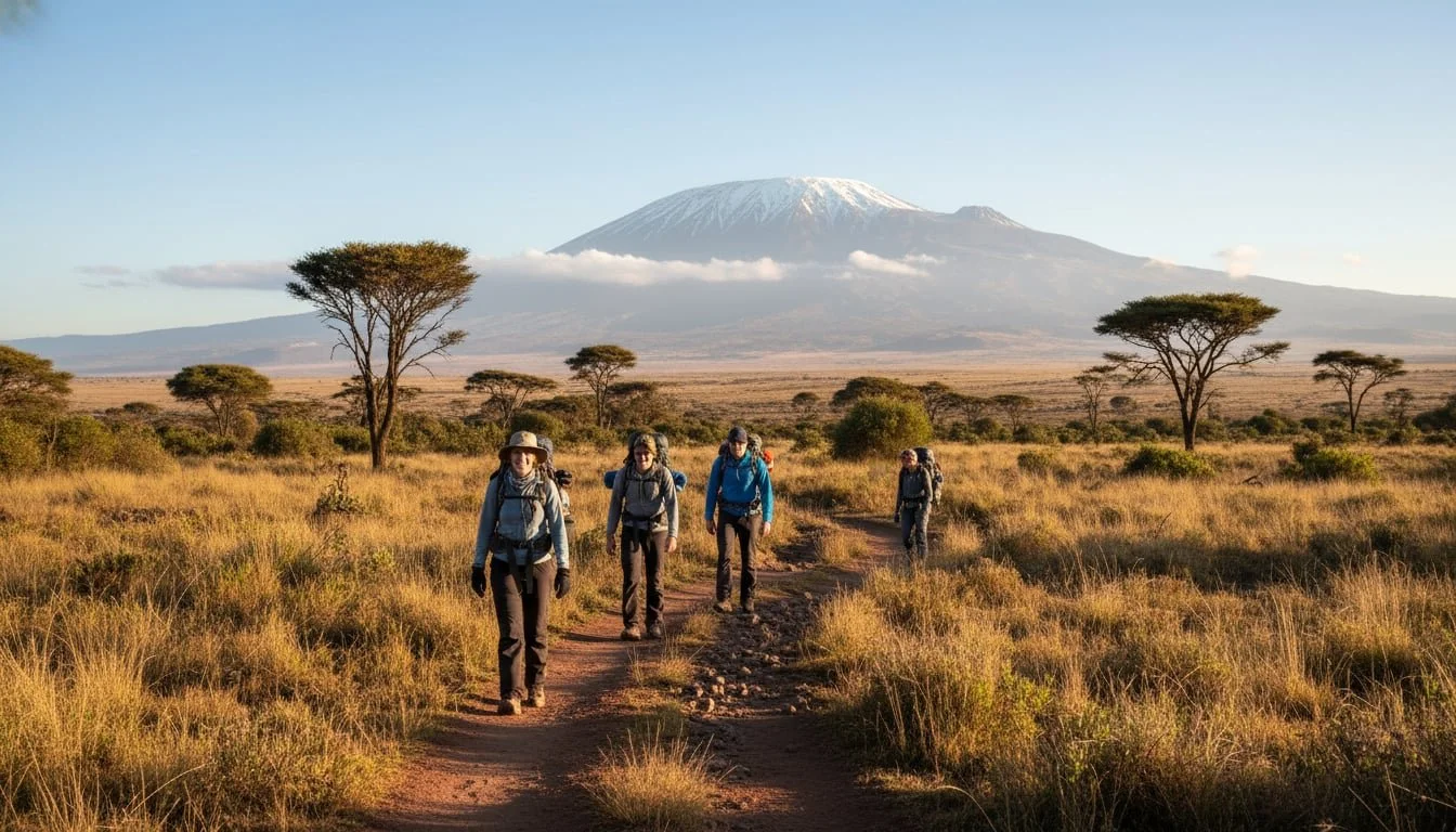
The Starting Line at Nale Moru (Rongai Gate)
Your adventure begins at the Nale Moru Gate, often just called Rongai Gate. This trailhead is located in a small farming village at an altitude of about 1,950 meters (roughly 6,400 feet). The drive to the gate itself is scenic, passing through local corn and potato fields with views across the plains into Kenya.
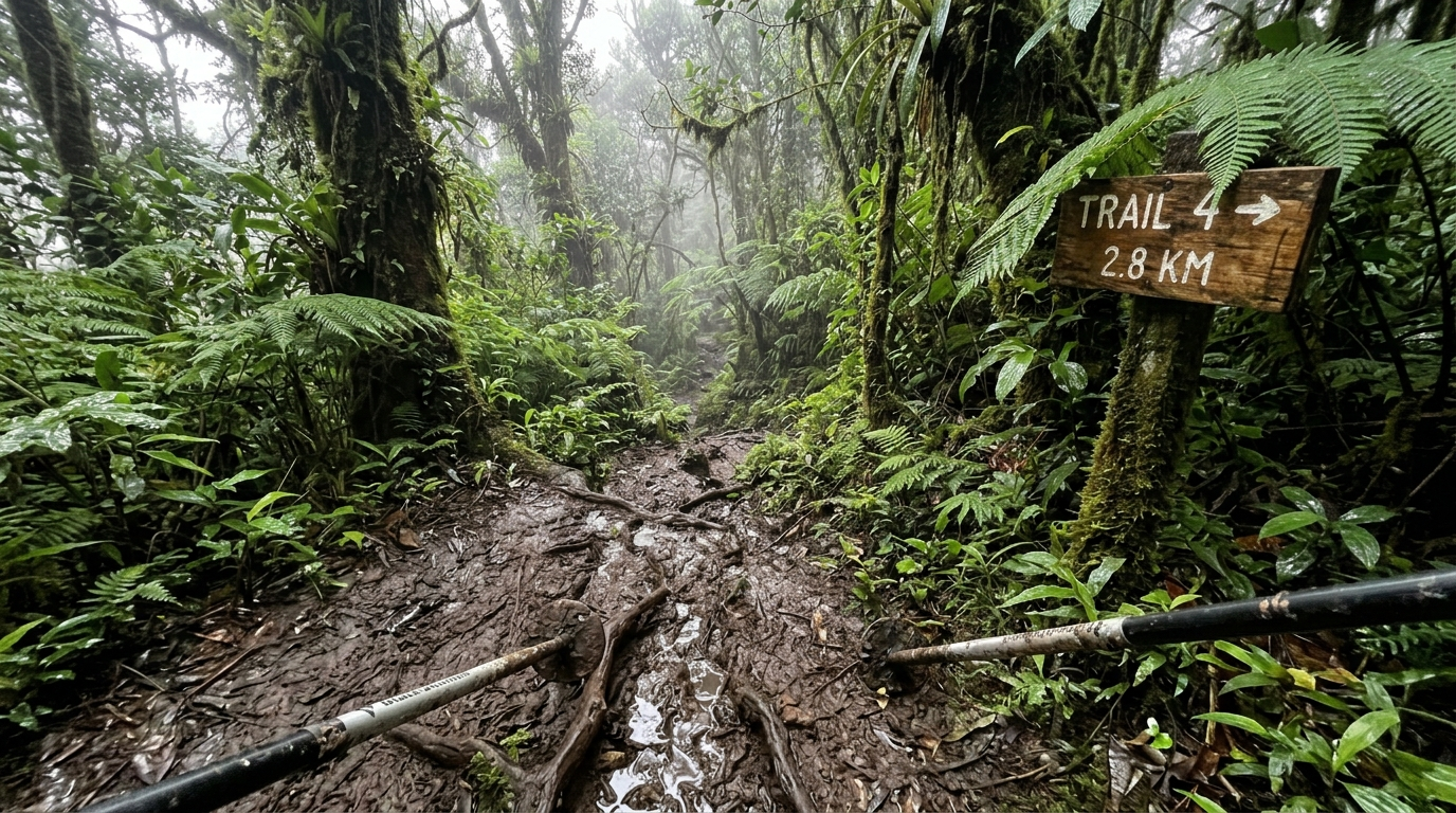
After registering at the park gate, your trek on the Rongai Route starts in a montane rainforest. This forest is thinner and drier than the jungles on the southern side, and the trail quickly transitions into open heath and moorland. In this initial woody section, you might even spot some unique wildlife, like the beautiful black and white colobus monkeys.
Mapping Your Journey
A map of the Rongai Route shows a fantastic traverse of the mountain. You ascend from the north and descend down the southeast, meaning you get to experience two different sides of Kilimanjaro without backtracking.
The map highlights the key landmarks and campsites along the way. You’ll see the path winding around Mawenzi Peak, Kilimanjaro’s dramatic secondary cone, before crossing the vast, lunar like saddle to Kibo, the main summit cone. The route joins the Marangu trail at Kibo Huts for the final ascent to Uhuru Peak and then follows the Marangu path all the way down to the exit gate on the opposite side of the mountain.
By the Numbers: Distance, Duration, and Altitude
How Long is the Rongai Route?
The total trekking distance for the Rongai Route is approximately 70 to 74 kilometers, or about 43 to 46 miles. This journey is typically completed over six or seven days. However, a seven day itinerary is highly recommended. That extra day, usually spent acclimatizing at Mawenzi Tarn, dramatically improves your chances of a safe and successful summit. On an average day, you can expect to hike for four to eight hours.
A Gentle Climb: The Altitude Profile
The altitude profile of the Rongai Route is one of its biggest selling points. The climb is known for being very gradual and steady, which is excellent for helping your body adapt to the altitude. You start at around 1,950 meters and ascend in manageable steps each day.
While the route has a gentle incline, it does lack the natural “climb high, sleep low” opportunities found on trails like Machame. This is why the seven-day itinerary with an extra acclimatization day is so crucial to reduce the risk of altitude sickness. The most significant altitude challenge is summit night, when you climb about 1,200 vertical meters from Kibo Hut to the peak. By then, five days of gradual ascent will have prepared you for that final push.
How to Prepare for the Rongai Route
To ensure a successful summit in 2026, your physical preparation should begin 3–4 months in advance. While the Rongai Route is gradual, the summit night is grueling.
-
Cardio: Focus on hiking, swimming, or cycling to build lung capacity.
-
Strength: Prioritize leg strength (quads and calves) and core stability.
-
Hiking Practice: The best training is hiking in your summit boots with a weighted daypack (5–7kg) to build "trail legs."
-
Mental Toughness: Be prepared for long days and cold summit temperatures.
The Ideal Seven Day Rongai Route Itinerary
A seven day trek is the best way to experience the Rongai Route, balancing steady progress with essential acclimatization. Here’s what you can expect day by day.
-
Day 1: Rongai Gate to Simba Camp. The trek begins with a gentle 3 to 4 hour hike through forest and moorland to Simba Camp (2,635 m), located near a feature known as First Cave.
-
Day 2: Simba Camp to Kikelelwa Camp. You’ll continue through the heathland, enjoying beautiful views of Kibo’s eastern glaciers. The path leads to Second Cave (3,450 m) for lunch before continuing to Kikelelwa Camp (around 3,600 m) for the night.
-
Day 3: Kikelelwa Camp to Mawenzi Tarn. This is a shorter hiking day but a significant altitude gain, bringing you to the stunning Mawenzi Tarn Camp (4,315 m). This camp sits beside a picturesque alpine lake at the foot of the jagged Mawenzi Peak. The afternoon is spent resting and acclimatizing.
-
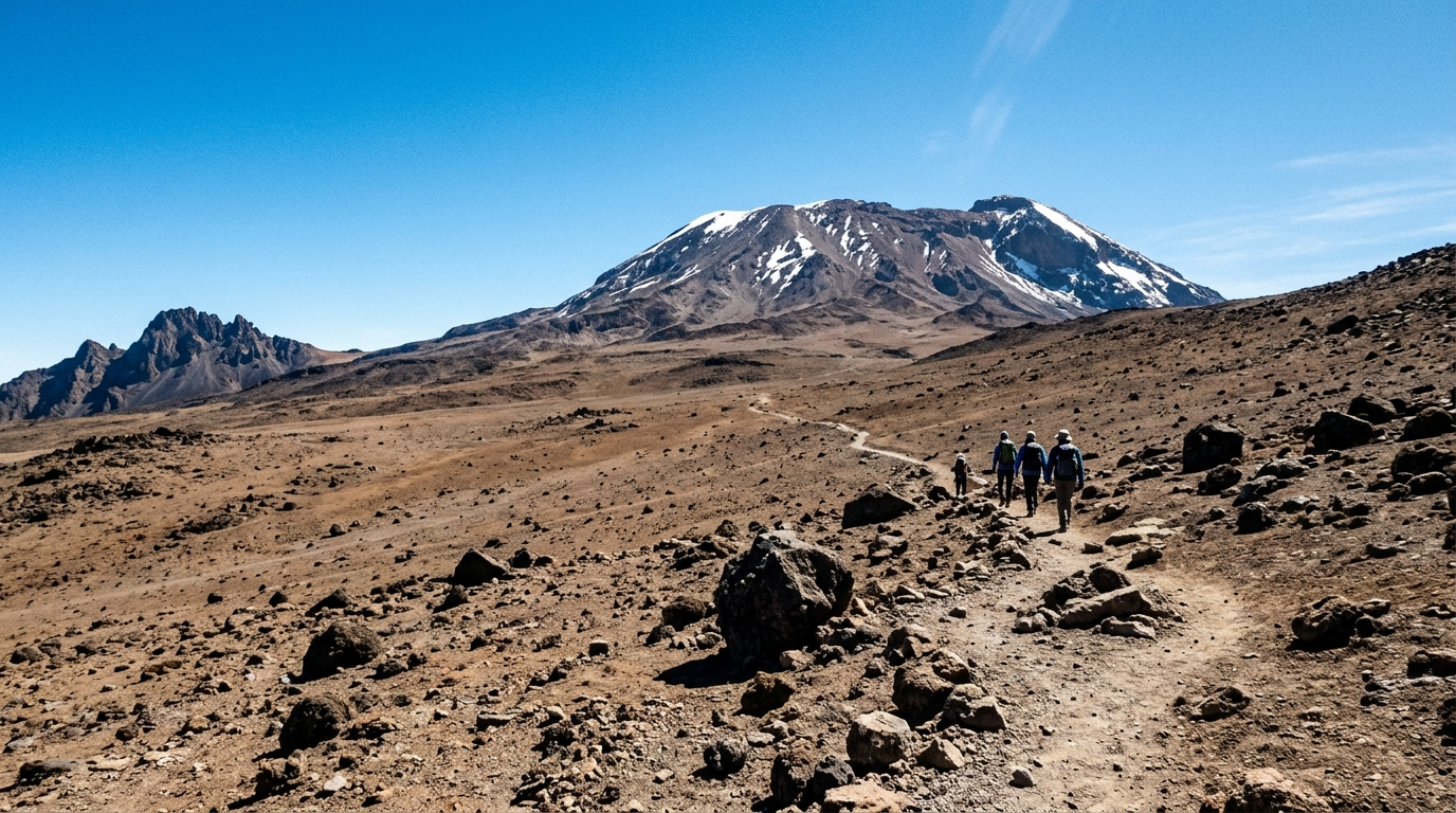
Day 4: Mawenzi Tarn to Kibo Hut. Today you cross the famous Saddle, a wide, barren plateau that connects Mawenzi and Kibo. The landscape feels like a desert on the moon. After about 8 km, you reach Kibo Huts (4,703 m), your base camp for the summit attempt.
-
Day 5 (Summit Day): Kibo Hut to Uhuru Peak, then down to Horombo Hut. Your day starts around midnight with a tough, slow climb up the steep scree slopes of Kibo. After about 5 to 6 hours, you’ll reach Gilman’s Point (5,681 m) on the crater rim as the sun rises. From there, it’s another 1 to 2 hours around the rim to Uhuru Peak (5,895 m), the highest point in Africa. After celebrating, you descend back to Kibo Hut for a short rest and then continue far down to Horombo Hut (3,720 m).
-
Day 6: Horombo Hut to Marangu Gate. The final day is a long but beautiful descent through the rainforest on the Marangu route. The 19 km trek takes about 5 to 7 hours, ending at Marangu Gate (1,860 m), where you’ll sign out and receive your official summit certificate.
-
Day 7: Departure. This day is typically for resting after the climb and preparing for your journey home or your next adventure. If time allows, unwind on Zanzibar’s best beaches before you fly home.
For climbers seeking a safe and well planned experience, Duma Explorer’s standard Rongai Route treks are seven days, prioritizing proper acclimatization for the best chance at the summit.
Summit Day: Gilman’s Point to Uhuru Peak
Summit day on the Rongai Route is the ultimate test of endurance. After an early wake up call around midnight, you begin the slow, steady trek from Kibo Hut. The path is a series of switchbacks on loose volcanic scree, making it the most challenging part of the entire climb. For peace of mind, read our guide to helicopter evacuation on Kilimanjaro.
You’ll hike for hours in the cold and dark, guided by your headlamp. Around dawn, you reach Gilman’s Point (5,681 m) on the crater rim, a massive achievement in itself. The sunrise from this vantage point is breathtaking. From here, the trail to Uhuru Peak is a gentler incline along the crater’s edge. It takes another hour or so to finally reach the iconic sign at Uhuru Peak (5,895 m), the true summit of Kilimanjaro. You’ll spend a short time taking photos and soaking in the 360 degree views before beginning the long descent.
A Grand Traverse: Descending via Marangu Gate
One of the best features of the Rongai Route is that it’s a traverse. You descend via the Marangu Route on the mountain’s southeast side, which means you’re always seeing new landscapes.
The descent is long but straightforward. After summiting, you’ll spend the night at Horombo Hut (3,720 m). The next day involves a continuous downhill trek of about 20 kilometers through the lush rainforest, a stark contrast to the dry northern side. You finally emerge at Marangu Gate, where you’ll sign out of the park and celebrate your incredible accomplishment.
How Hard is the Rongai Route?
The Rongai Route is considered one of the easier climbs on Kilimanjaro. Its difficulty is moderate, with a gradual ascent and no technical climbing sections like the Barranco Wall. This makes it an excellent choice for first time high altitude trekkers and those with less backpacking experience.
The real challenge, as with any Kilimanjaro route, is the altitude. Because the Rongai ascent is so steady, it’s vital to take the seven day option to allow your body to acclimatize properly. The success rate for the seven day Rongai Route is very high, often around 80% or more. The six day option has a noticeably lower success rate.
Expert guiding makes a huge difference. Operators like Duma Explorer prioritize safety with highly experienced, Wilderness First Responder certified guides who set a proper “pole pole” (slowly, slowly) pace and monitor your health throughout the climb. Use our guide to choosing the best Kilimanjaro operator in Moshi to vet providers.
Solitude and Scenery on the Mountain
If you want to avoid crowds, the Rongai Route is an outstanding choice. It’s one of the least traveled trails, offering a peaceful and remote atmosphere. For the first few days, you may hardly see another soul outside of your own group. This solitude only changes when the trail merges with the Marangu Route at Kibo Hut.
The scenery is beautifully rugged. You’ll hike through a dry forest, open moorlands dotted with giant groundsels, and across the stark alpine desert of the Saddle. The views of Mawenzi Peak are particularly dramatic.
Rongai is also the best route for potential wildlife sightings. Because it’s so quiet, animals are less disturbed. It’s common to see black and white colobus monkeys in the forest. There’s even a small chance of spotting larger animals like antelope, buffalo, or even elephants on the lower slopes, a rare treat on Kilimanjaro.
When to Climb: The Best Season for the Rongai Route
While Kilimanjaro can be climbed all year, the best times are during the dry seasons from January to February and June to September. However, the Rongai Route has a unique advantage: it’s the best route to climb during the wet seasons (April, May, and November). Its location in the mountain’s rain shadow means it receives far less precipitation, keeping the trail drier and more pleasant when other routes are muddy.
No matter when you go, summit night will be very cold, with temperatures often dropping well below freezing. But for the ascent, Rongai generally offers milder and drier weather than any other trail.
Frequently Asked Questions about the Rongai Route
Is the Rongai Route good for beginners?
Yes, the Rongai Route is highly recommended for beginners. Its gradual slope and steady pace make for a forgiving acclimatization profile, and there are no technical sections that require scrambling.
What kind of accommodation is on the Rongai Route?
Accommodation is in mountain tents at designated campsites. Your crew will set up and take down your tents each day. Only on the descent do you stay at Horombo Hut, which has A frame sleeping shelters.
How crowded is the Rongai Route?
It is one of the least crowded routes on Kilimanjaro. You will enjoy a quiet, wilderness experience for most of the ascent before joining the more popular Marangu Route for the summit push and descent.
Can I see wildlife on this route?
Yes, Rongai offers the best chances for wildlife viewing. Colobus monkeys are common, and because the area is so remote, larger game like antelope and buffalo are sometimes seen on the lower slopes.
What is the success rate for the Rongai Route?
The success rate is very high, especially on the seven day itinerary, which often sees 80% or more of climbers reaching the summit. The longer duration is key for proper acclimatization.
Essential Packing List for 2026
Don't forget these specific items for the drier, dustier northern slopes:
-
Gaiters: Essential for the scree on summit night and dust on the lower slopes.
-
4-Season Sleeping Bag: Temperatures at Kibo Hut can drop to -15°C (5°F).
-
Buff or Face Mask: The northern side can be windier; protection from dust is key.
-
Hydration Bladder: 3L capacity is recommended, plus an insulated cover for the tube to prevent freezing on summit night.
Ready to take on this incredible journey? Explore customized Kilimanjaro climbs with Duma Explorer and consider pairing your ascent with one of our 7 to 10 day Tanzania safari itineraries.